Day 17 - Sunday, April 21 - At the Foot of the Mountain
Today we headed toward the possibly real Mount Sinai, where tomorrow we hope to imitate Moses by climbing up at least a part. Today we explored the area around it.
According to the Exodus account, the Israelites camped on a low plain nearby the mountain, and there is a plain here and it is plenty big enough. For comparison, we looked at how much area the 3 million people need who go to Mecca for the annual Hadj and also largely live in tents, and compared to that, this plain can accommodate 6 million people living in tents.
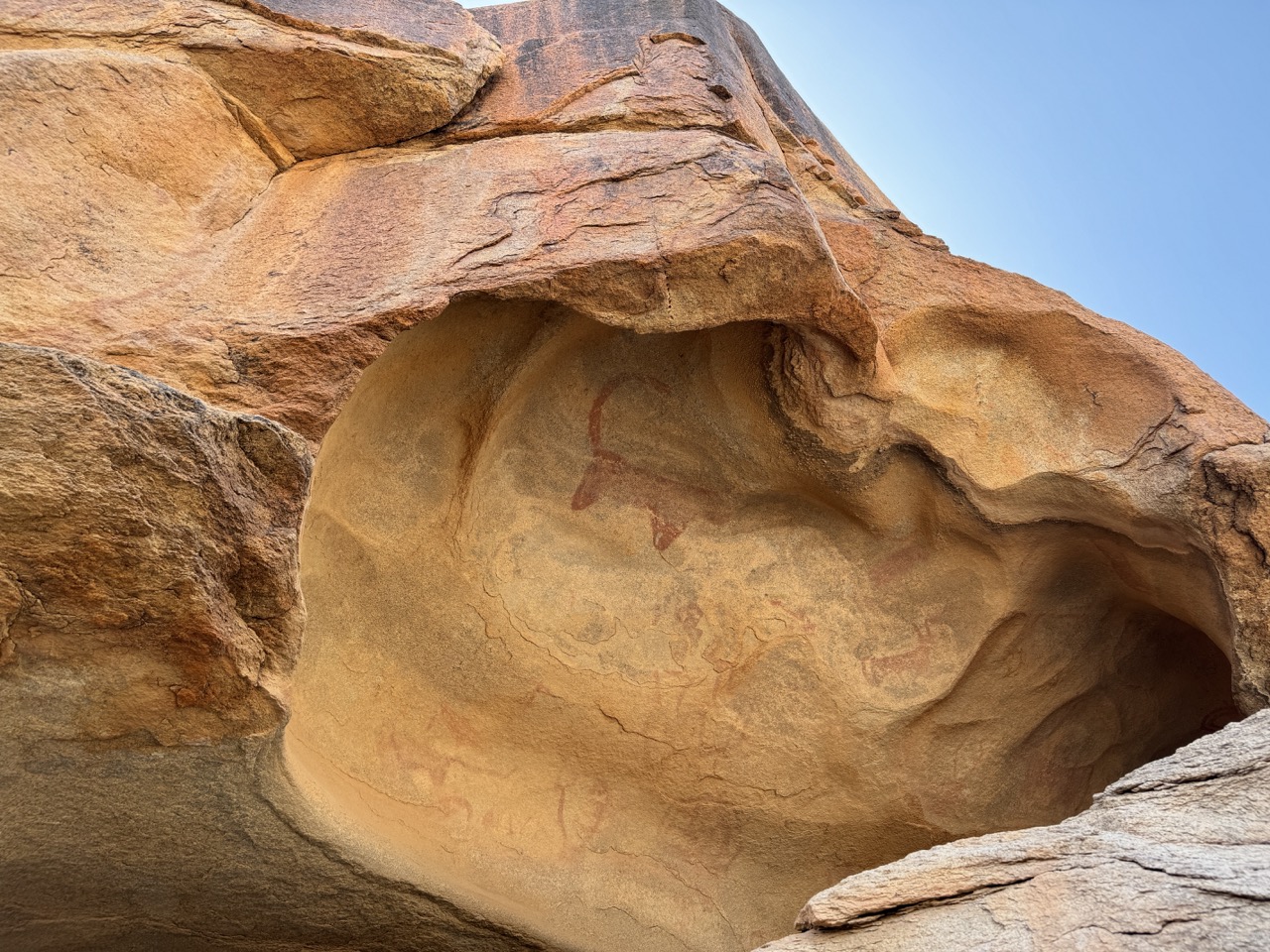
There is a small elevation that may very well have been the place where Moses had pitched his tent, just outside the camp. And from this plain you can see the top of the mountain, with more in the foreground and a bit lower a cave that may have been the one the prophet Elijah walked to, coming from Samaria (1 Kings 19:8. It seems that the names of Horeb and Sinai are used interchangeably for the area where the mountain is, and with more than one top).
Remarkable how much more greenery and shrubs grow in this area. So it makes sense that Moses headed here to have more food for the sheep (Exodus 3:1).
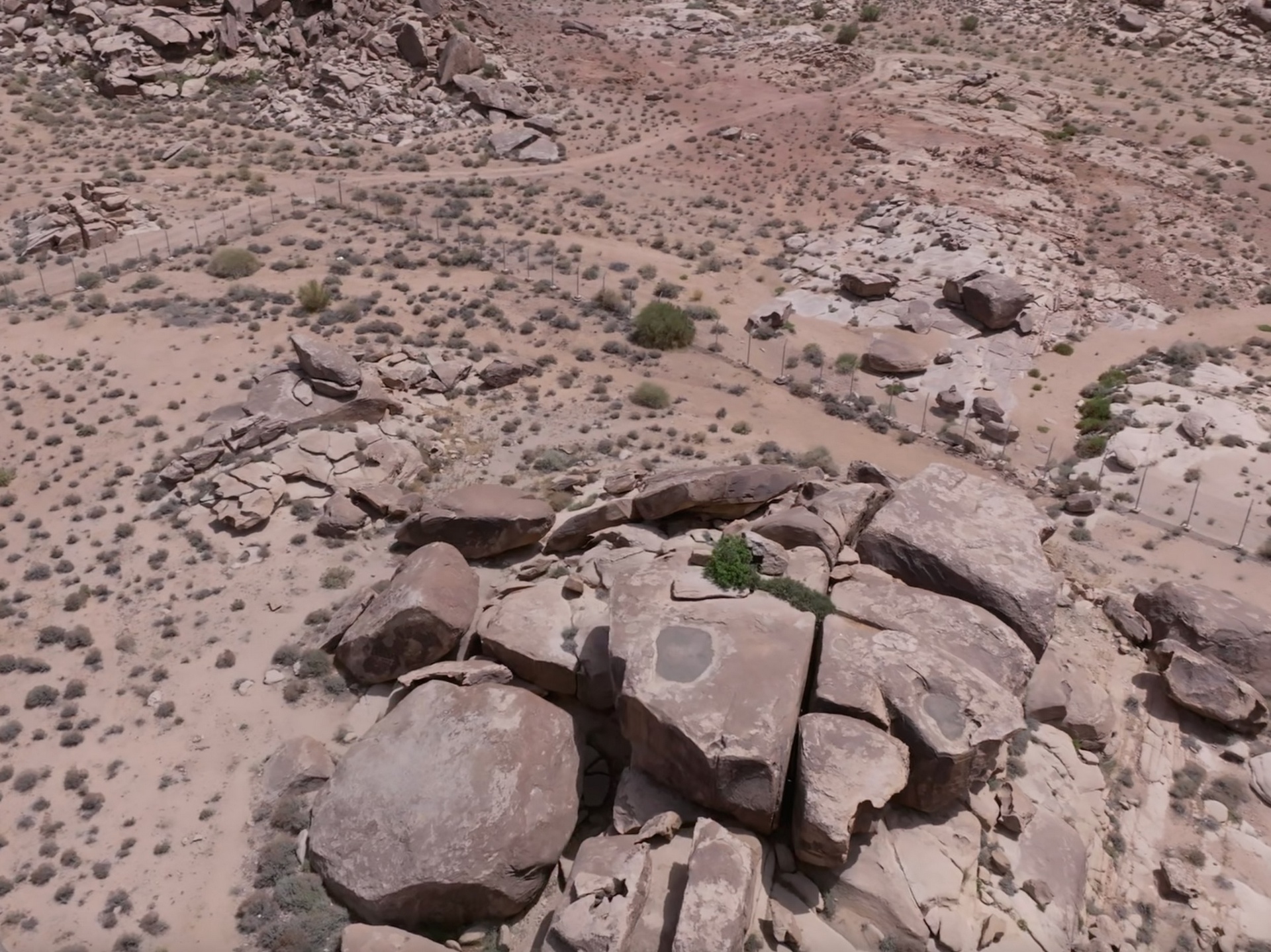
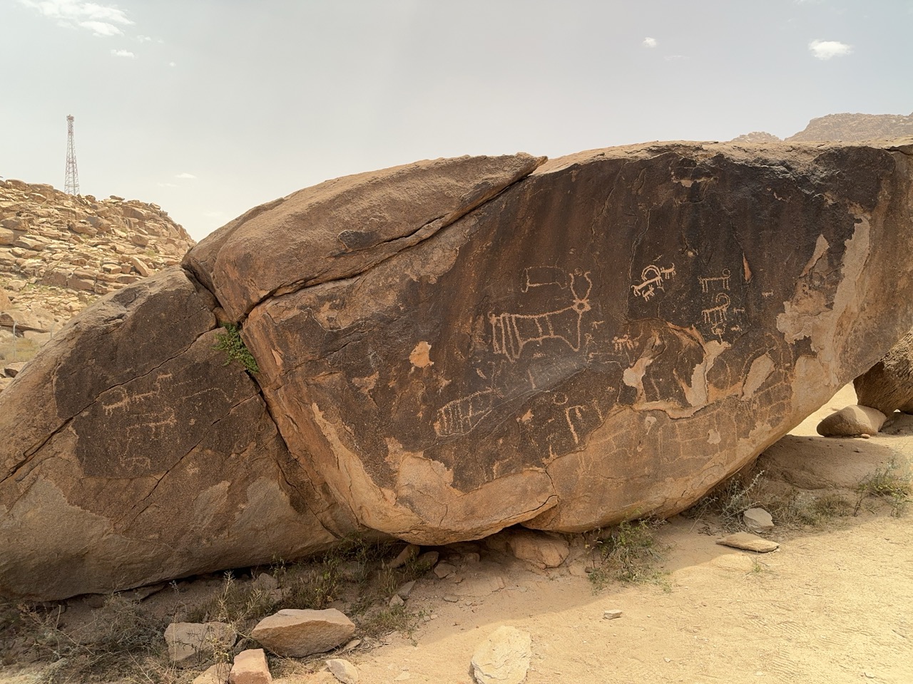
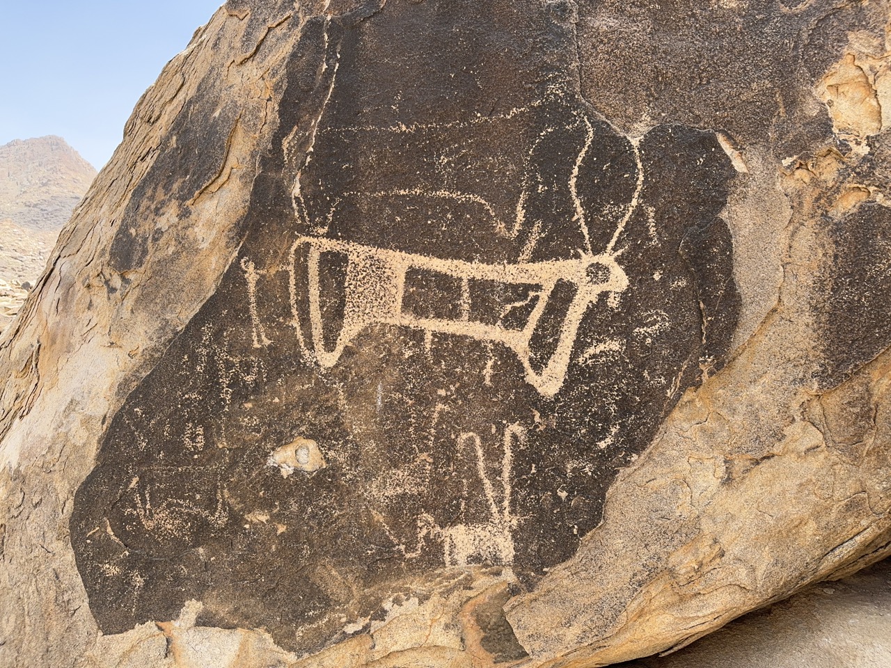
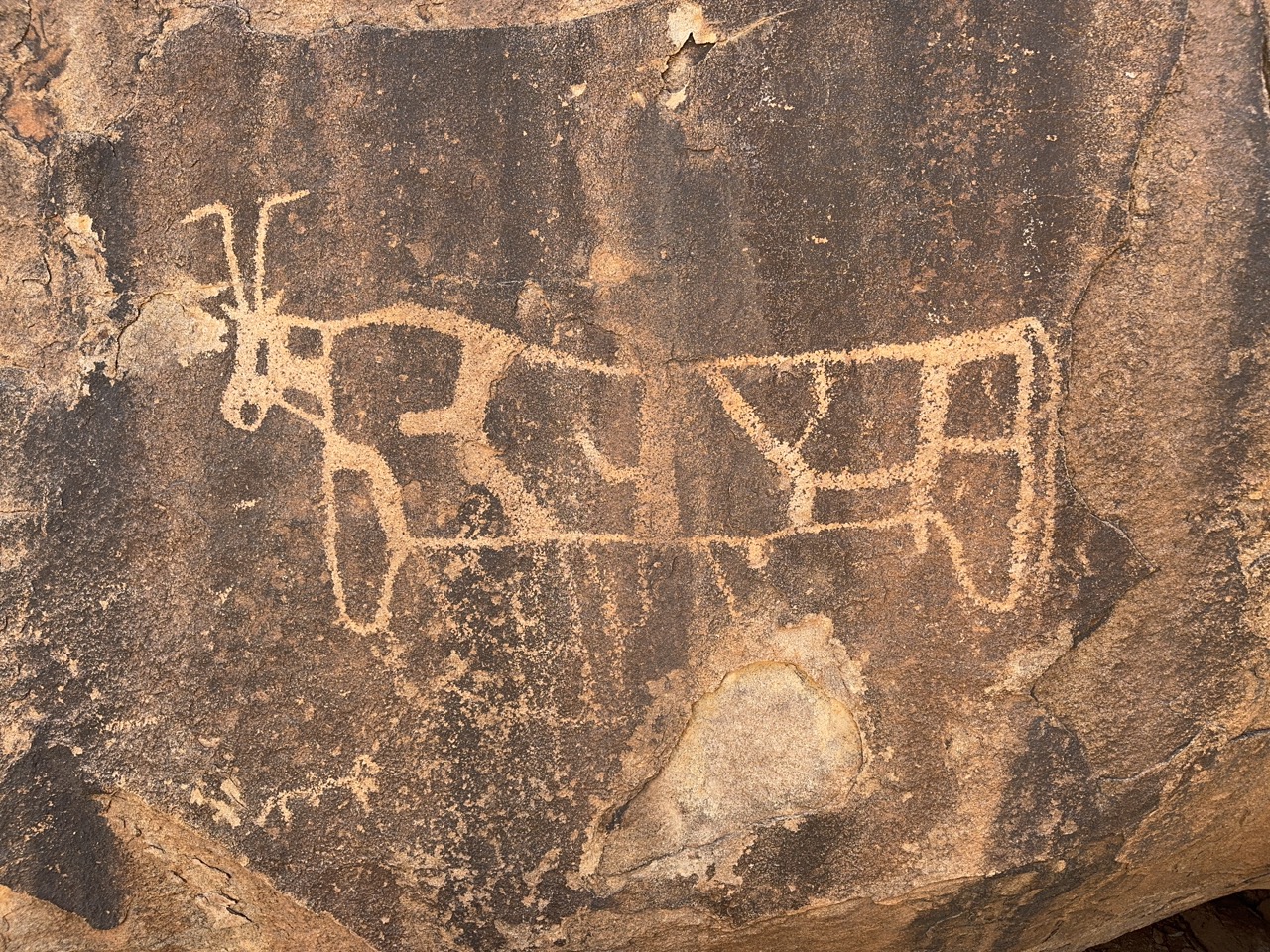
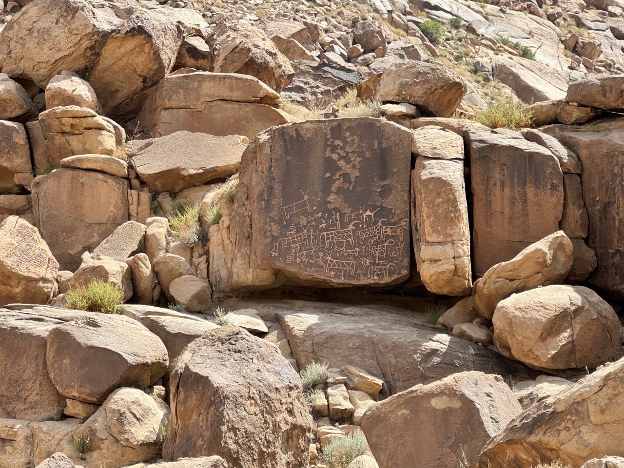
If you go from the plain towards the mountain you come across a group of large stones that seem, at least the top layer with large stones, were manually laid there. And with lots of very ancient inscriptions that almost all indicate calf or bull worship. Archaeologists from Saudi Arabia, who have no motivation to confirm our suspicions, estimate the inscriptions to be at least 3,500 years old. Therefore, it is plausible that here the worship of the one true God was soon "adapted" in an inappropriate way.
This large stone pile does not have the characteristics of an altar, but what could be is that the image of the calf was placed on this stone pile, and next to it we see a smaller stone pile that may have been an altar and may well have been built in one evening, which matches the description in Exodus 32:4-6.
Toward the foot of the mountain you come to a place where from the arrangement of the stones it can be seen that this was not a dwelling, it looks more like a way to lead animals to slaughter, perhaps animal sacrifices, because Moses had set up an altar at the foot of the mountain according to Exodus 24:4, and animal sacrifices were made on it as was customary at that time.
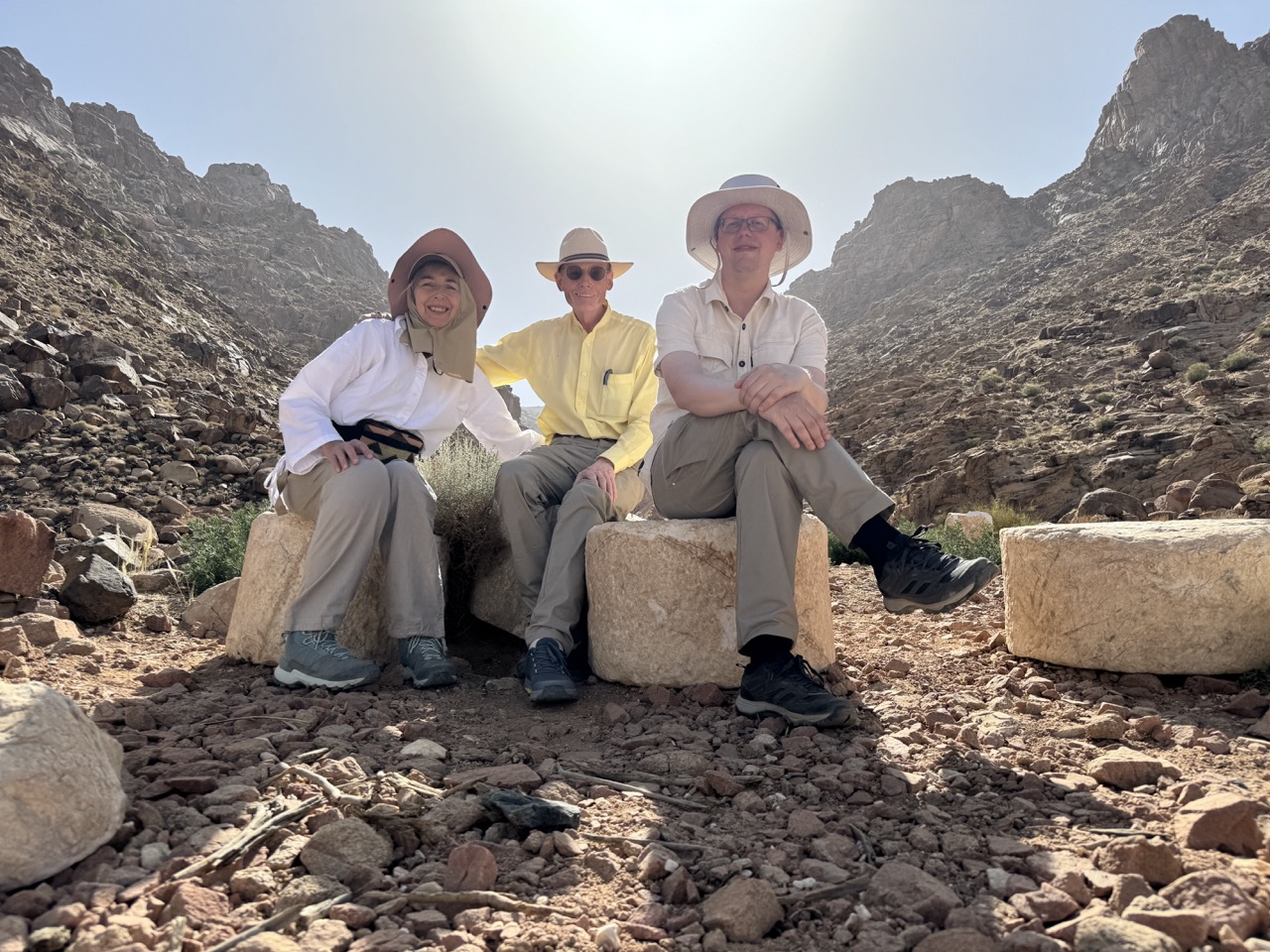
And we have seen ten round carved stones, from a marble quarry on the other side of the mountain, 60-63 centimeters in diameter and 21-43 in height with one of 65 as an outlier. This is reminiscent of the 12 pillars or columns that were erected at the foot of the mountain to represent the 12 tribes of Israel, also according to Exodus 24:4.
On the way back, you can see the mountain from the other side, and that it has three summits. The front peak is the lowest, the back the highest. It could be that all of it was called Horeb and the most visible summit or just the most high Sinai (compare Psalm 68 verse 15, where Basan is called one mountain but with several peaks).
Videos:
(1) The great plain that could be the camping site for the Israelites at the foot of the mountain. You see first in the foreground the place where possibly Moses had pitched the tent of meeting, just outside the camp of the Israelites (Exodus 33:7). Then in the background you see the mountaintop that Moses may have climbed up to, and a 360 degree view of the immense plain where the Israelites may have camped.
(2) Look how many very old inscriptions of calves or bulls you see. It seems quite possible that calf worship took place here.
(3) At the foot of the mountain a possible slaughterhouse through which animals were led, and remains of at least 10 columns or pillars still there today.
(4) The possible cave of Elijah in the foreground of what might have been called Horeb, with the mountaintop in the background that is called Mount Moses by the locals. And they don't say that for the tourists, because they have never been here before.
Photos:
(1) The small stone heap at the side of the big one that could have been the altar for the golden calf. (2-5) all inscriptions of bulls on this large heap of stones. (6) More inscriptions, but on the road to the foot of the mountain. (7) Drawing of the possible animal abattoir. (8) Ron & Karin and Marco on some of the marble pillars there. (9) The peak you see in the other photos from the front is in this photo the leftmost of the three consecutive peaks. You also see there is enough green to eat for the sheep and other animals.